
An antique world map does something few other prints can. It is a work of art, a historical document and a conversation starter all at once. The engraved coastlines, decorative borders and occasional blank spaces show the world as mapmakers understood it centuries ago, with confidence in some places and guesswork in others. This guide walks through the golden age of world maps, introduces the mapmakers behind the prints we sell and offers practical advice on choosing a size and a room for one.
Why the seventeenth century produced such beautiful maps
In the late 1500s and 1600s, the Low Countries became the center of European mapmaking, with Amsterdam at its heart. Dutch trading voyages brought back new coastal information, printers had mastered copperplate engraving, and a prosperous merchant class wanted handsome atlases and wall maps. Competing publishing houses issued and reissued world maps for decades, often updating plates as new information arrived and adding ever richer decoration.
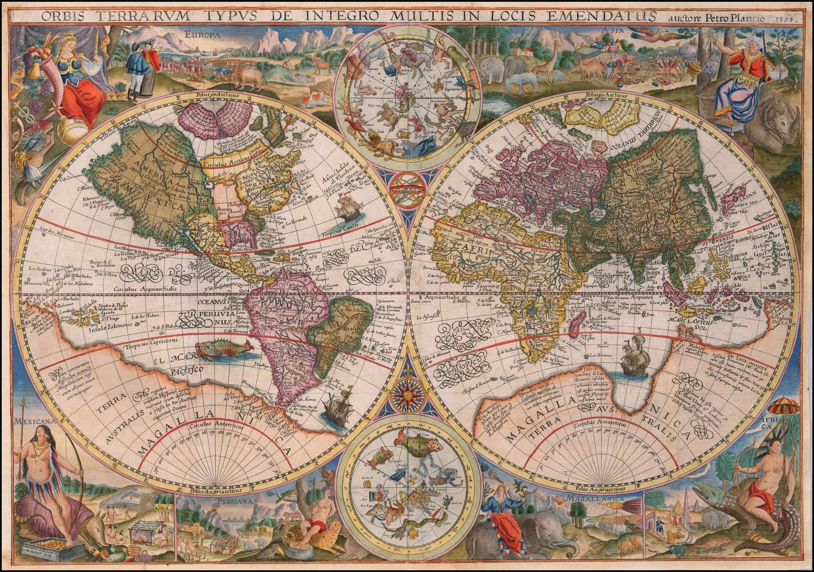
Many of the maps from this era use a double-hemisphere layout, showing the world as two circles side by side, roughly the Old World on one side and the Americas on the other. The corners and borders around those circles became a showcase for engravers, filled with allegorical figures, celestial diagrams, the seasons or the elements. Color was usually added by hand after printing, which is why surviving copies of the same map can look quite different.
The engraved coastlines and occasional blank spaces show the world as mapmakers understood it, with confidence in some places and guesswork in others.
The mapmakers in our collection
Petrus Plancius was a Flemish-born theologian and cartographer working in Amsterdam who advised early Dutch voyages to the East. His Orbis Terrarum of 1594 is a double-hemisphere map from the very start of the Dutch golden age, and its framing decoration depicts the continents. It is the oldest map in our collection and a natural centerpiece.
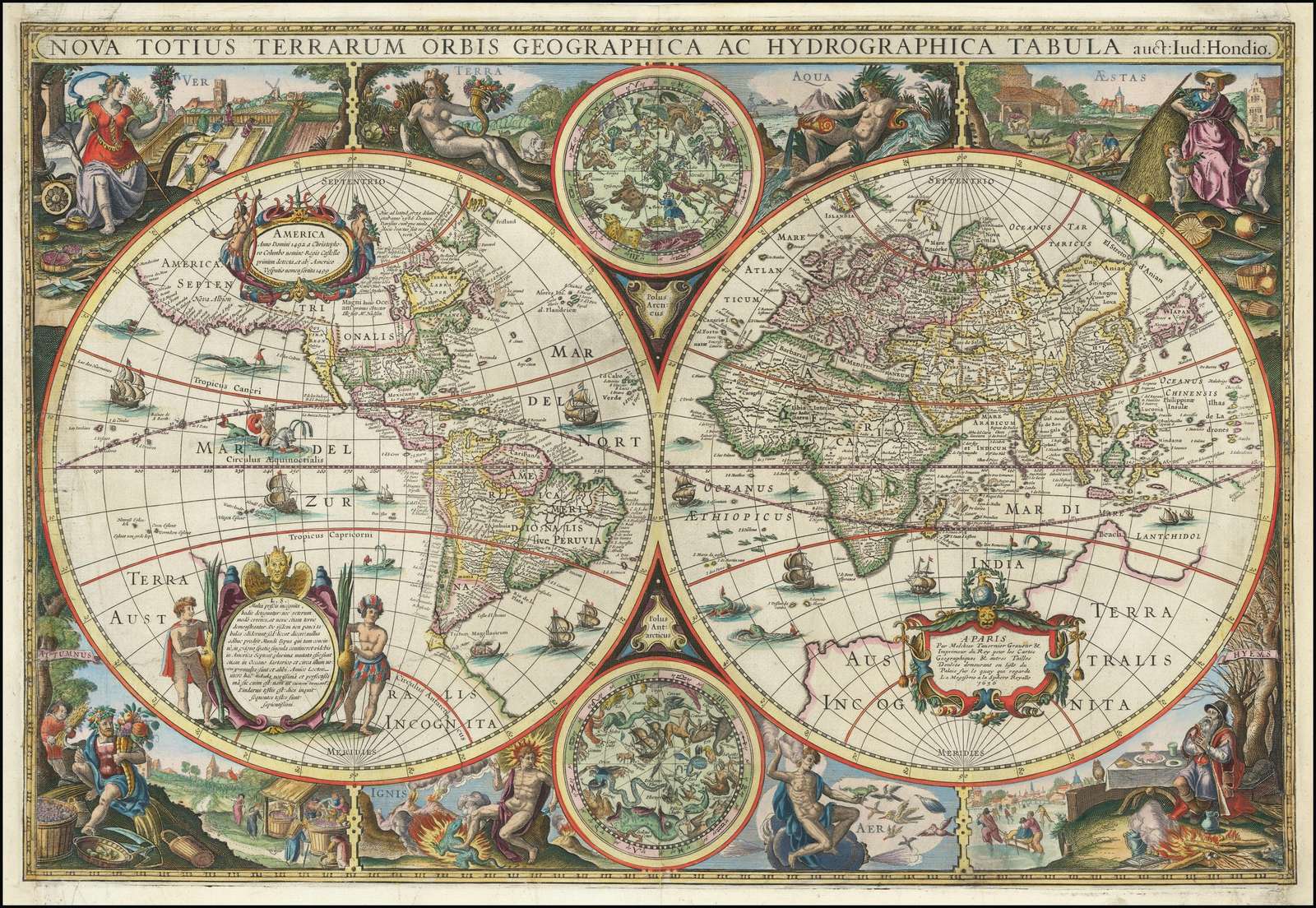
Henricus Hondius belonged to a family at the center of the Amsterdam map trade; his father, Jodocus Hondius, had acquired the plates of Gerard Mercator’s atlas. Henricus’s Nova Totius Terrarum Orbis Tabula of 1636 is one of the most admired decorative world maps of the period. His brother-in-law Jan Janssonius was a major publisher in his own right, and his Orbis Terrarum Descriptio of around 1650 continues the double-hemisphere tradition.
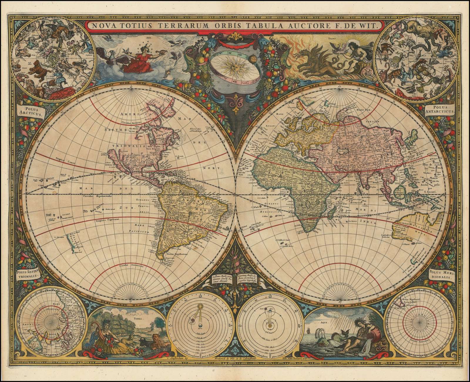
Later in the century, Amsterdam publishers such as Frederik de Wit and Carel Allard kept the tradition going. De Wit’s Nova Totius Terrarum Orbis Tabula of 1660 is bold and richly ornamented, and Allard’s world map of 1696 brings the style toward the end of the century. Mapmaking was flourishing elsewhere too: Giacomo Giovanni Rossi published his world map in Rome in 1674, and in Paris Alexis-Hubert Jaillot issued his world map of 1699, reflecting the rise of French cartography.
Beyond the world map: cities and regions
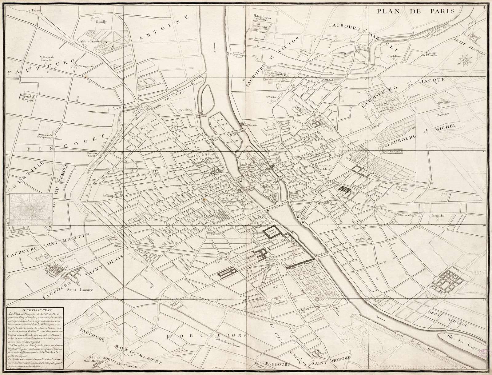
If a whole world feels too broad, a city or regional map can be more personal. The Turgot Map of Paris, drawn by Louis Bretez and published in 1739, was commissioned by Michel-Étienne Turgot, then head of the city’s municipal government. It shows Paris in a bird’s-eye view, street by street and building by building, and it rewards close looking like few maps do. Jan Janssonius’s Plan of Paris in 1657 shows the city nearly a century earlier.
For sailors and anyone who loves the Mediterranean, Johannes van Loon’s Chart of the Eastern Mediterranean of around 1661 is a working sea chart with compass roses and rhumb lines. James Rennell’s Map of Hindoostan (1788 edition) comes from the age of systematic survey; Rennell had served as Surveyor General of Bengal, and the map is a meaningful gift for anyone with family roots in South Asia.
Where an antique map works best
- Home office or study: the classic choice. A world map above a desk says curiosity without saying much else.
- Living room: a Large double-hemisphere map over a sofa reads as a single strong horizontal shape, and its warm parchment tones go with wood, leather and linen.
- Entryway or hallway: a city map such as the Turgot Map of Paris invites people to stop and look.
- Child’s room or reading nook: early maps, with their sea monsters, allegories and missing coastlines, are a lively way to talk about how knowledge grows.
Choosing a size
Antique maps are full of fine lettering and engraved detail, so size matters more than it does for a bold poster. Every FrameAnyPhoto print is made at the map’s true proportions, with nothing cropped, and most of our maps come in three sizes:
- Small, $195 (about 20 inches on the long side): good for a gallery wall, a bookshelf or a pair flanking a window.
- Medium, $295 (about 24 inches): the everyday choice above a desk, console or dresser.
- Large, $395 (about 36 inches): the size we recommend for world maps whenever the wall allows. At Large, the place names and decorative corners are readable from a comfortable distance, and the map becomes a true focal point.
A black metallic frame keeps an antique map feeling crisp and contemporary, while the ornate wood frame suits a traditional room or a library. For a series, hang two or three maps of different eras in matching frames and the same size, so the eye compares how the world changed between them.
Browse all of our antique world maps, see the wider maps collection, or pair a Paris map with the paintings in our Paris art prints.


